Indoor navigation on your smartphone, using the Earth’s magnetic field — just like a pigeon
July 12, 2012 | Source: ExtremeTech
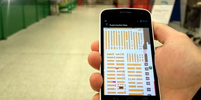
An indoor positioning system (IPS) that uses the Earth’s magnetic field to determine your location is accurate between 0.1 and 2 meters, according to IndoorAtlas, a company spun off by the University of Oulu in Finland.
The system is based on the fact that every square inch of Earth has a magnetic field that is modified by man-made concrete and steel structures. Almost every smartphone has a built-in magnetometer (compass) sensor that is sensitive enough to create magnetic field maps with an accuracy of 10 centimeters.
Creating a map is simple: drawing out a floor plan, then walk around a location so that the magnetometer can build up a map, using apps provided by IndoorAtlas. Then, if you’re visiting an area that has a magnetic field map, you can run the IndoorAtlas service to get a map.
The IndoorAtlas solution is a low-cost alternative to conventional IPS systems, which require you to blanket a venue with thousands of WiFi or Bluetooth base stations. It requires no extra infrastructure.
Possible uses: airports, hospitals, underground parking lots, subways, shopping malls, and miners. There is an API for developers.
Downsides: the World Magnetic Model has to be updated every five years, and accuracy may be affected by the presence of iron-containing cars and magnetic fields from motors, speakers, and other devices

