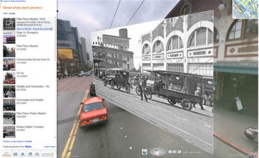
Microsoft adds ‘Augmented Reality’ to Bing Maps
February 12, 2010 | Source: Technology Review
 Microsoft’s new Streetside Photos stitches real images and video clips onto the Bing Map’s street-level view, using a clever combination of geolocation information (from a GPS-enabled device, or added manually by the user) and imaging-matching algorithms for a mashup with geotagged Flicker photos (intially for Vancouver, Seattle, and San Francisco).
Think of it as Photosynth in reverse.
